In this post I will write about the covered bridges that span the Conestoga River.
As promised, I will be writing about the upper Conestoga because it so happens that all of the remaining covered bridges across the Conestoga are on the upper river. (You will note from my first post that I have divided the river into upper and lower sections using the 462 bridge at Bridgeport as the dividing line.)
At present there are five remaining covered bridges that span the Conestoga. A sixth one was removed to Lancaster County Park. I will list them here in order as the river flows.
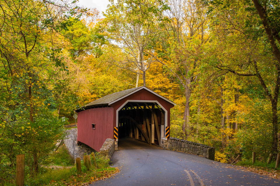
Poole Forge
Poole Forge is the site of an iron forge that operated at the close of the 18th century. Some of the iron would have been used to make armaments for the Revolutionary war. The forge closed in 1852 with the decline of the iron industry. In 1858, a number of citizens signed a petition for Lancaster County to build a covered bridge across the Conestoga Creek at Poole Forge. The bridge was constructed in 1859 at the location where the “Downingtown and Ephrata Turnpike” crossed the Conestoga. The bridge is 99 feet long. Today, Poole Forge is open to the public as a park and is a popular venue for outdoor weddings.
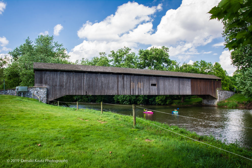
Weaver’s Mill
Located at the site of a former saw mill, Weaver’s Mill Covered Bridge was built in 1878. It is 85 feet long. The bridge is on Weaverland Road in East Earl, not far from Goodville.
Kurtz’s Mill
Kurtz’s Mill Bridge was built in 1876 and is 94 feet long. This bridge once spanned the Conestoga on Kurtz Road but was washed down river in 1972 by Hurricane Agnes. It is now located in Lancaster County Park where is spans the Mill Creek.
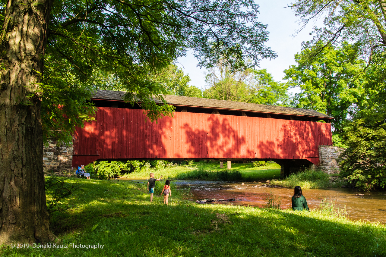
Bitzer’s Mill
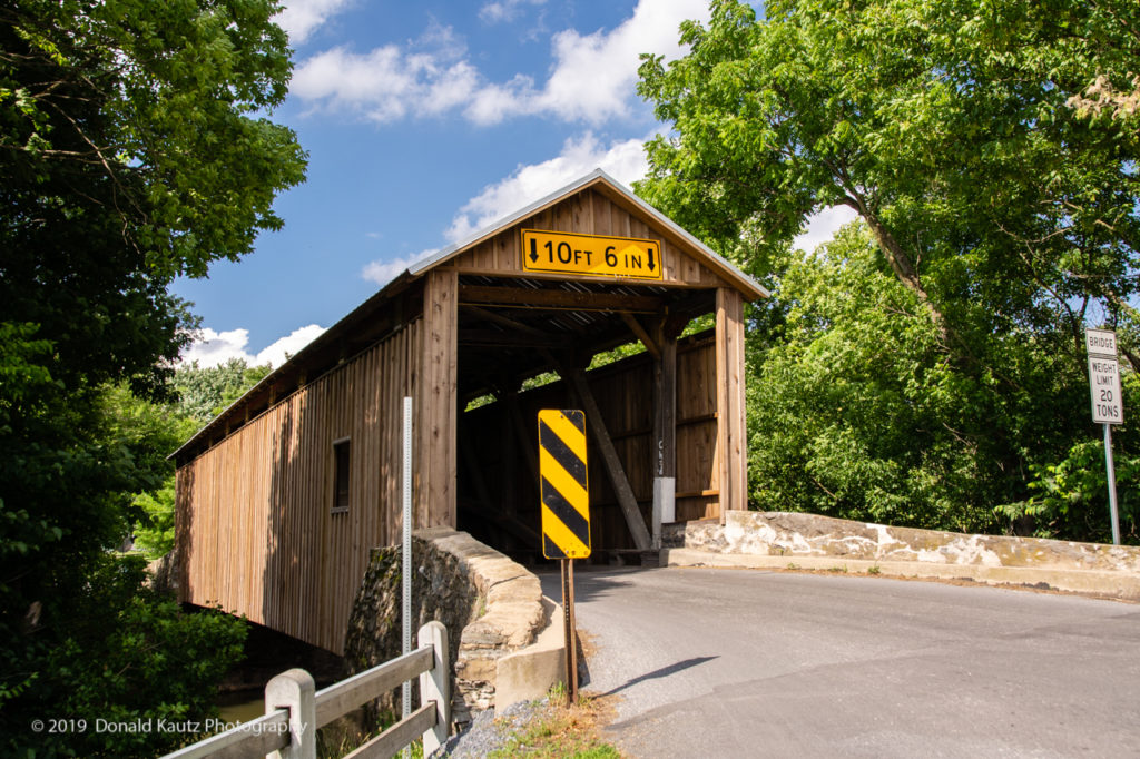
Bitzer’s Mill covered bridge, also known as Eberly’s Cider Mill bridge was built in 1846. It is 98 feet long and is the oldest bridge in the county still in use. The bridge was reconstructed in 1997. The bridge was damaged in 2015 when someone attempted to drive an oversized vehicle through the bridge. The bridge has since been repaired.
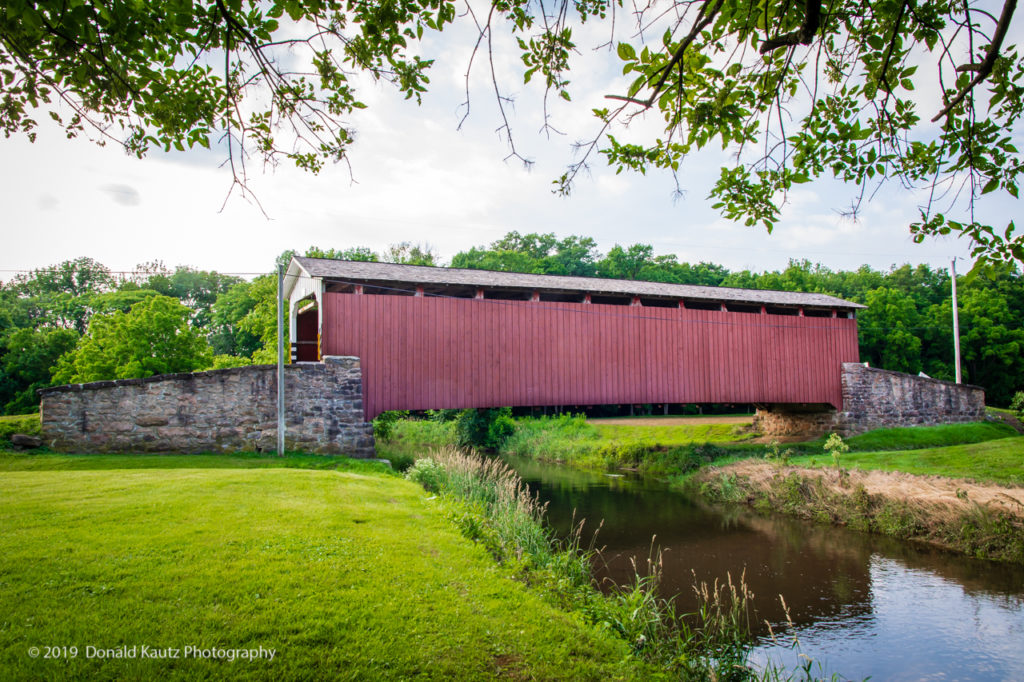
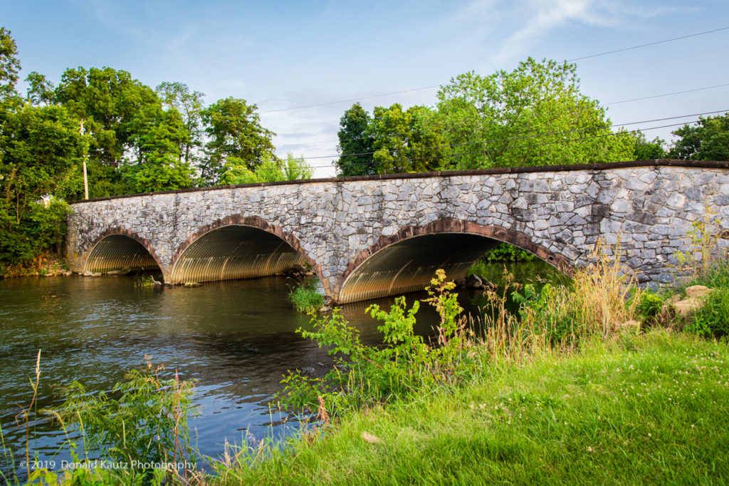
Pinetown
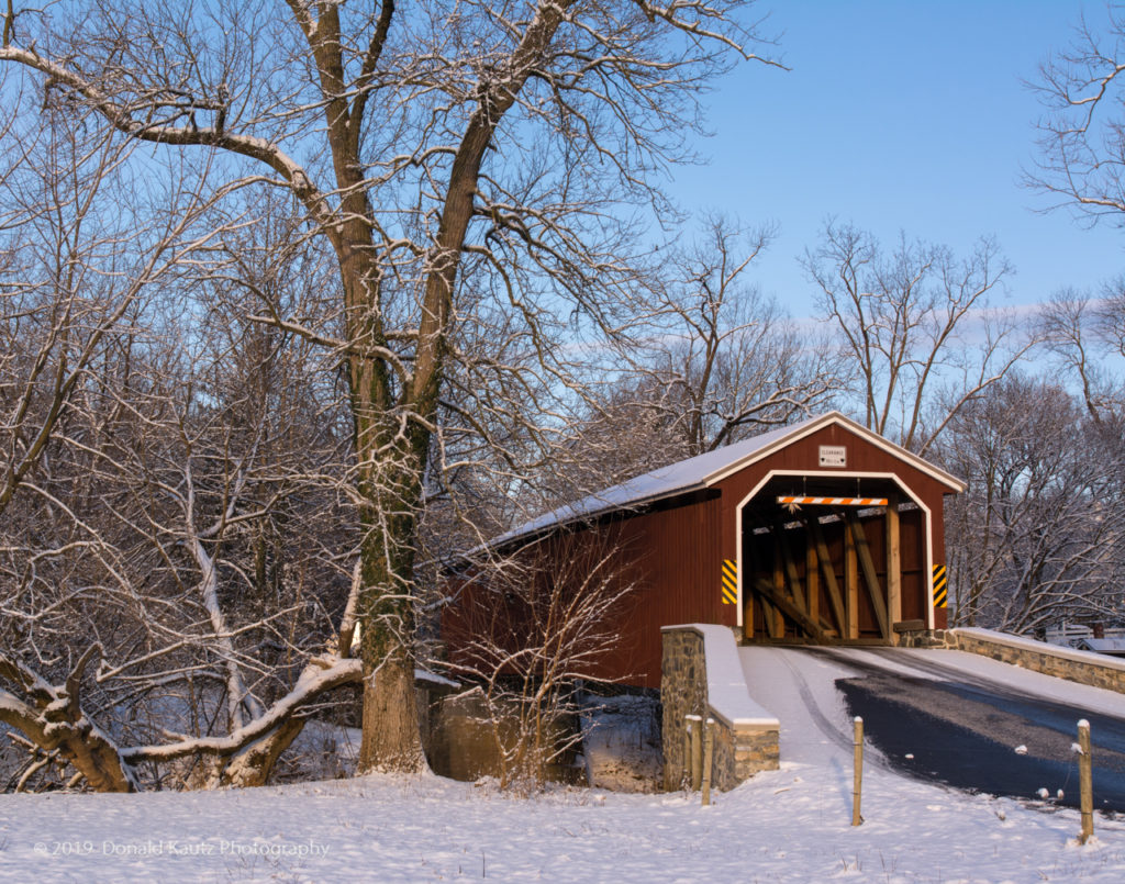
Pinetown (not really a town) is located at the confluence of the Lititz Run with the Conestoga. In 1846, Henry Leman founded a water-powered rifle barrel boring mill at Pinetown. In the next several years, thousands of rifle barrels were bored in this location. In 1865, the boring business was relocated to Lancaster City at the corner of Walnut and Cherry Alley after which the mill at Pinetown fell into disrepair. A small stone-arch bridge across Lititz Run still marks the location of the mill.
The covered bridge across the Conestoga at Pinetown was built in 1867. It measures 133 feet long. The bridge was washed downstream by Hurricane Agnes in 1972 and subsequently rebuilt by Amish. That bridge was damaged by Tropical Storm Lee in 2011 and was reopened in 2014.
Hunsecker’s Mill
Built in 1843, at 180 feet, it is the longest, single-span covered bridge in the county. Destroyed in 1972 by Hurricane Agnes, it as since been rebuilt. The original cost to build was $1,988. In 1973 it was rebuilt for $321,302. This bridge has horizontal floor boards which give it a unique feel as you drive across. It’s interesting that on one side of the bridge, the road is called “Hunsecker Road” while on the other side it is called “Hunsicker Road”.
There are, of course, many other covered bridges in Lancaster County. These are just the ones that span the Conestoga River. And there are many other bridges that span the Conestoga, these are just the ones that are covered. I will “cover” some of those other bridges in later posts.